Surf’s Up!

by Karen

On our way to the Bavarian National Museum (which is pretty neat, with lots of art from the middle ages to the 1800s), we walked by the English Garden, one of the largest recreational parks in Munich.

As we crossed a bridge, we noticed a sizeable crowd gathered on the railing, looking down at the river. We decided to see what to commotion was about, and were rewarded with probably one of the coolest things we’ve seen in Munich:
20131226-191928.jpgSurfers!
20131226-191945.jpgSurfing on a river!

The Eisbach River in the English Garden is a very popular spot for surfers. If you follow the river downstream, you’ll come across several spots where the river crests into waves. The interesting thing is that the government allows it, even posting signs next to the river warning surfers of the concrete barriers underneath the surface.
20131226-193137.jpg20131226-193151.jpg
The surfers wait in line and wait for each other to fail before they hop on their surfboards. Because the current flows at a constant (very fast) speed, there is hardly any downtime and no need to wait for a wave to rise, when compared to ocean surfing.

So if you ever visit land-locked Munich and have a great urge to catch some waves, here would be a great spot!
20131227-003508.jpg20131227-003649.jpg

Camels! In the Sahara!

by Karen

We were dropped off at our hotel in Merzouga at the edge of the Sahara Desert. Then we proceeded to ride our camels out for an hour, watched the sun set, and rode a bit further to camp, where we ate dinner. We were joined by couples from Bulgaria, Malta, and France, and I was able to chat with them throughout the night, getting their perspectives in traveling around Morocco. Unfortunately, Mark wasn’t feeling too good, and ended up throwing up his dinner. 😦

On the flip side, we both were able to take a peek at the night sky and see a ton of stars. I climbed a sand dune next to our camp (it’s a lot harder than it looks), and just perched myself on the top. The view was breathtaking.

Anyway, camels. Sahara. Wow.

20131109-204044.jpg

20131109-204013.jpg

20131109-204229.jpg

20131109-204419.jpg

20131109-232603.jpg

20131109-232615.jpg

20131109-232625.jpg

20131109-232637.jpg

20131110-000358.jpg

20131110-000433.jpg

20131110-000449.jpg

20131110-000502.jpg

20131110-000512.jpg

20131110-000545.jpg

20131110-000600.jpg

20131110-000623.jpg

20131110-000643.jpg

20131110-000803.jpg

20131110-001021.jpg

20131110-030306.jpg

20131110-030331.jpg

20131110-030343.jpg

20131110-030357.jpg

20131110-030408.jpg

20131110-030424.jpg

20131110-030435.jpg

20131110-030446.jpg

20131110-030459.jpg
Thanks, buddy, go get some rest!

Ourika Valley, High Atlas Mountains

by Karen
20131107-235421.jpg
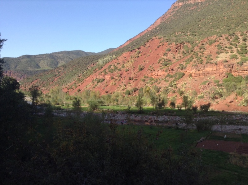
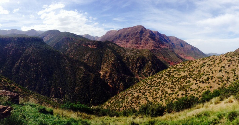
Ourika Valley is nestled within the heart of the High Atlas Mountains, about 45 mins east-ish of Marrakech. Most people usually visit as a day trip, then return to the city. It’s mostly hiking trails, beautiful (lush!) scenery, picturesque villages, and waterfalls that draw tourists to the area.
20131107-232125.jpg
We pretty much spent our 1.5 days hiking up mountains and enjoying the scenery. The afternoon we arrived at our hotel, we decided to check out the waterfall. It was a bit underwhelming (and overcrowded), having already seen magnificent waterfalls in Iceland.
20131107-235904.jpg
The hiking was strenuous, but good, it was about a 3hr hike roundtrip. Our guide from the hotel, Ahmed, didn’t speak any English at all, but we managed to be able to understand each other.
20131107-235917.jpg
20131107-235928.jpg
To get to the trail, we had to catch a local “bus”, which was essentially a van with as many people squeezed in as possible. It was a fun adventurous ride, albeit watching your driver take sharp turns along cliffsides and driving onto oncoming traffic can cause quite an adrenaline rush.
20131108-004107.jpg
At the bottom of these cliffs was a large riverbed, which at the moment is quite dry. The river usually fills up during the winter rains. But for now, the dry river provides for nice cafe seating.
20131108-004128.jpg
20131107-235440.jpg
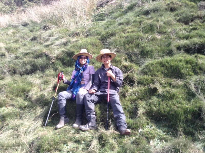
Our second day was the big hike. The hotel owner recommended us to take this trail, which would give us excellent views of the valley, and allow us to visit a Berber village. He was right; despite the altitude sickness and heat, the valley was gorgeous, and not something we’d expected to see in Morocco, land of deserts and dried-up rivers.

It took us approximately 4 hours to reach the village. We took many breaks along the way, and I was quite embarrassed about how out of shape I was (our guide was 60, and he was running up the mountain!)
20131108-004941.jpg
20131108-005017.jpg
20131108-005357.jpg
20131108-005424.jpg
20131108-005345.jpg
20131108-005412.jpg
The owner of the hotel had even arranged a cooking lesson for me from one of his chefs, since I mentioned that I loved to cook. I was able to eat the result, a tasty tagine of kefta meatballs.
20131108-015508.jpg
In all, we enjoyed our stay in Ourika Valley. It was a nice mixture of relaxation and hiking, and wish we could’ve stayed an extra day.
20131108-015717.jpg

Essaouira – A Quiet Little Seaside Town

by Karen

I’ll be honest, Marrakech was wonderful in all its sights and smells, people, foods, and activities, but it was somewhat mentally stressful. Yes, we had culture shock, and we always had our guard up. We’d been pickpocketed (thankfully for us, both attempts were unsuccessful), chased after by “local guides”, and harrassed by market vendors. Getting lost in a labyrinth of neverending dark alleyways with no street signs, landmarks, lights, or noises can be very scary. We could never truly relax. And on that note, we were off to the next place on our itinerary, Essaouira!

(The bus from Marrakech to Essaouira is 140DH, runs 8x/day, and is a 3hr ride, with pit stop. You’ll also need to buy a separate ticket for your luggage, 5DH per bag.)
20131101-184240.jpg
20131101-184300.jpg
20131101-184323.jpg
Essaouira is a complete breath of fresh air, both literally and figuratively. It sits right on the Atlantic coast, with great views of the ocean and sunset. It used to be a fortified city in the 18th century, and the town itself is still surrounded by remnants of its walls and towers. On the pier, surrounded by brightly-painted blue rowboats and fishing vessels, is what remains of the Essaouira Ramparts, with beautiful views of the town itself, and providing soldiers a tactical vantage point to fire upon enemies invading its waters.
20131101-184514.jpg
20131101-184545.jpg
20131101-184606.jpg
20131101-184625.jpg
20131101-184747.jpg
20131101-184829.jpg
20131101-184909.jpg
20131102-014815.jpg
Essaouira is also refreshingly small. At least the town within the city walls. Whereas Marrakech was a jumble of streets, Essaouira only has two major streets, both completely parallel to each other, with the smaller side streets in a gridlike pattern (more or less). You could get lost, but it would be very easy to find your way again. You could also easily walk the whole town within two hours.
20131101-184411.jpg
20131101-184439.jpg
Because of its small size, there really aren’t many attractions in the area. This is a place to unwind, relax, catch some sun, and enjoy the ocean breeze. There is a very big beach that gets crowded in the summer. The Ramparts are the only main attraction here. There are a lot of tourists in town, but the atmosphere here is very chill, relaxed, and calm. The street vendors are not aggressive. We felt extremely lazy here, and we were totally ok with it.
20131102-014916.jpg
20131102-014932.jpg
20131102-015037.jpg
20131102-015050.jpg
20131102-015116.jpg
On the pier, there is are several fish stalls where you can order a plate of fish, and they grill it right in front of you. All the stall prices are fixed, so there’s no danger of being cheated. The fish is also fresh, as the fishing boats come back to harbor around noon with the day’s catch (so it’s best to go at lunchtime!). The sardines are probably some of the best I’ve ever had. On the flip side, we will probably stay away from street food for the rest of our stay in Morocco, as the aftermath of the experience is not something we’d want to try again!
20131102-015004.jpg
20131102-015016.jpg
We stayed at Riad Chakir Mogador, conveniently located next to one of the main streets. It was nice when we’d buy stuff and think “Oh, let’s just go drop this off at our room,” or if there was an emergency, “Oh, let’s go back to our room and use the bathroom.” It’s probably bigger than the riad we stayed at in Marrakech, but a lot cozier and homey.
20131102-014846.jpg
20131102-020630.jpg
20131102-020700.jpg
20131102-020728.jpg
Some people stay in Essaouira for a few days, others stay for weeks. We’re only here for 2 nights, but wish we could’ve stayed a 3rd, just to unwind a bit more. 🙂
20131102-015131.jpg

Iceland, Day 5 & 6 Recap – South Coast Tour, Hallgrimskírkja, Sundhöll

by Karen

(Note: finally getting around to posting an old draft! Originally written Oct 2, covering Sept 29 & 30, 2013)

To briefly summarize, we took another Sterna Tour to Iceland’s South Coast (a part of the famous Ring Road).

We saw:
– Seljalandsfoss waterfall (we could walk behind it, or as the Jungle Cruise at Disneyland says, “the backside of water!”)
The volcano that caused massive flight traffic across Europe in 2010
– Reynisfjara beach (with black sand and basalt columns)
Skógafoss waterfall & the Skógar Folk Museum
– a giant glacier that we could walk on

Volcanoes in the distance

This time around we had a different tour guide, she was young, and didn’t really interact much with the group, but she knew a lot of history. Although at the very beginning of the tour, she picked up the wrong people from a hotel and drove for an hour before realizing this! We had to drive back towards the city and meet up halfway with another bus that had the other tourists, and made a swap.

Our first stop was the Seljalandfoss waterfall. It looked gorgeous, and it was pretty neat to be able to walk behind it.

The backside of water!

Miraculously the weather was amazing that day. The sky cleared up, and we could see three volcanoes in the distance:
Hekla, which is Iceland’s main volcano;
Eyjafjallajökull (I’ll just call her “Eyja”), which threw up so much fine dirt and ash into the sky, it canceled a ton of flights across Europe for days;
– and Katla, still active

We went to a little museum that showed a short documentary about how the Eyja volcano affected farms and families that lived under it, and showed the aftermath of its eruption and the cleanup.

“Eyja”

Reynisfjara Beach was probably my favorite stop of the day, which had black sand beaches and impressive-looking basalt columns and caves. There were also rock formations in the water. Folklore states that the colums were trolls that got caught in the sunlight and turned to stone.

Trolls in the distance…?

Reynisfjara Beach

Basalt Rocks

Once we left the beach, we headed towards a glacier. This was probably the most exciting part of the day, because our driver took our minivan off-roading! I didn’t think the van was properly suited for such driving, but I buckled my seatbelt and threw my hands in the air. After about 15 minutes of driving on rocky terrain, we arrived at our destinaion, and took a short hike to the base of the glacier. There were a few groups already there in their full hiking regalia, but our merry crew was content with just touching the glacier, lest we fall into the cracks and face certain doom.

To be honest, when I think of “glacier,” I usually think of a giant chunk of ice just floating in the water. This glacier was receding into the mountains, slowly carving a valley into the rock. It was also very dirty, and covered in ash and dirt from previous eruptions. Once you brush off the black soot, you are greeted with a bright blue solid layer of ice.

Black glacier

Afterwards we headed towards a folk museum of Icelandic culture, Skógar. The history goes, some guy just randomly started collecting old items one day and eventually hoarded so much that he decided to make his collection into a museum. There were many quirky artifacts and tidbits of history taught inside. For example, I had never known that Iceland was once invaded by Turkish pirates(!!!) and many Icelanders were captured and forced into slavery in parts of the Middle East and northern Africa. The folk museum also had several recreations of old farmhouses, and they looked like Hobbit holes to me.

Old whaling boat

Hobbiton

Near the folk museum was a waterfall, Skógafoss, and you could either hike up to the top, or walk up to its base. We decided to walk to the base of the waterfall and, unsurprisingly, got drenched from head to toe.

Puny waterfall…

On our last day, we decided to take it easy again and just walked around town again. We finally decided to try some whale and puffin meat. We went to this restaurant on the Main Street, and although they only served puffin at dinner time (we got there at 3pm), we were able to convince the waitress to put in an order for us.

Puffin

…and whale

We came across Hallgrimskirkja, a large Lutheran church. Its architecture was inspired by the basalt columns of Reynisfjara. It’s at the top of a hill in Reykjavik, and supposedly has good panoramic views of the city. It looks great at sunset!

Hallgrimskirkja

Afterwards we checked out Sundhöll swimming pool. Not as fancy as the other one we went to, but much closer to our hostel (15 min walk, as opposed to 40), and had pretty much the same facilities. Along with more hot dogs, it was the best way to finish up our final night in Reykjavik!

Hot dogs and beer!

On an added note, we discovered a Filipino-Icelandic restaurant that served only one Asian-related dish.

Iceland, Day 5 Photos
More Iceland Day 5 Photos
Iceland, Day 6 Photos